Prepare now: Cyclone Gabrielle could rival intensity of 2018 storm
Published on 09 February 2023

The impact of Ex Tropical Cyclone Gabrielle on the Coromandel is likely to be similar to the 2018 storm and just below the intensity of Cyclone Bola in 1988. For this reason, the State of Emergency has been extended for another week across the Coromandel.
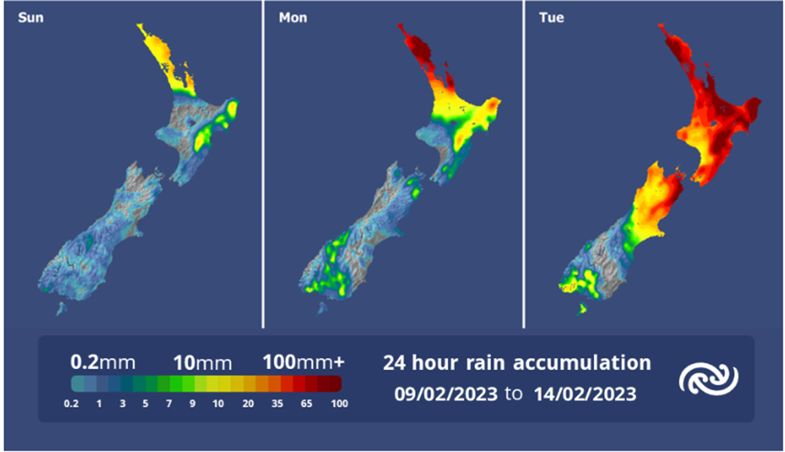
On its current course, Gabrielle will be felt on Sunday afternoon with increasing winds and rain, and this will gradually intensify through Monday before the full force hits on Tuesday morning. It will begin to ease through Wednesday.
Here is what we know already:
- Gale force easterly / northeasterly winds with gusts exceeding 135 km/h.
- Up to 300mm of rain between Monday and Wednesday.
- Storm surge across both the East and West coasts which will result in:
- Coastal inundation, across many lower lying areas, which could result in flooding of many beachside/ coastal urban areas.
- Isolation due to flooding and roading network blockages, trees down, power outages.
“Use these next three days to prepare and plan” says our Civil Defence Controller Garry Towler.
“This cyclone, the fifth severe storm we have had since November last year is packing a nasty punch, so for those living or staying in lower lying coastal areas think about and plan for evacuation. For everyone on the Coromandel get ready with supplies to last three days, and above everything else lock in a plan to be somewhere safe and secure by next Monday evening”.
A comprehensive update will be provided on Friday, including where we believe inundation and urban flooding could occur, an update on the cyclone and what support and resources are going to be available.