3pm update: A thundery day ahead for the Coromandel

Published on 24 February 2023

coro212.png

Latest update - Friday 24 February, 3:00pm

MetService has issued another update on the complex weather system currently across the Coromandel.

While there is no change to previous updates today (read them below) for the northern half of the Peninsula, the Firth of Thames is now in the firing line as well. 

Between 9pm tonight and 1am Saturday, up to 30mm/hr of rain is forecast to fall. This coincides with a King High Tide at midnight.

Surface flooding and slips along the Thames Coast road, together with possible road closures on SH25 if the Kauaeranga spillway is triggered, are likely.

Residents along the Thames Coast Road and Thames are urged to check that drains around property are clear and avoid travelling after dark if possible.

11:50am update

More intense weather has arrived on the Coromandel.

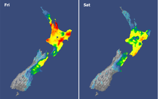
MetService says about 180mm of rain could fall in localised areas, especially in the northern half of the Coromandel, from late this afternoon through to 2am tomorrow morning.

Thunderstorms could result in over 40mm of rain falling within an hour, if this does happen surface flooding is very likely.

storm111.png

“Absolutely everyone is totally stormed fatigued and over this weather, but it is important to remain vigilant, well informed and safe during these kinds of storms” says our Civil Defence Controller Garry Towler.

Civil Defence urges all commuters and those travelling around the Coromandel this evening to take extra care as slips, debris and flooding could cause delays.

“All northern communities, including Cooks Beach, Whitianga, Kūaotunu, Matarangi, Opito Bay, Kennedy Bay are set to get downpours which could cause flooding and surrounding roads could also be impacted so please take care. For those in low lying northern coastal areas, the next high tide is at midnight and it will be very high as we are in the last days of the King Tide cycle, so ensure you are going to be safe, if not, consider going to family or friends further inland tonight while there is still daylight”

“If you live on or in front of a hillside, keep checking for cracks on your section that have developed or increased and contact us at Council if you have serious concerns” says Mr. Towler.

By the early Saturday morning the storm is forecast to pass over, and a calm weekend lies ahead.

9:30am update

Keep a close eye on the weather and road conditions today as a complex mix of rain, wind and thunderstorms intensifies over the next 20 hours.

Up to 140mm of rain with a possibly more is forecast with lightening and thunder dumping up to 40mm/h.

Slips, surface flooding, and power outages are likely, and we advise everyone to keep informed and safe. Where possible, stay off the roads.

We will provide further updates as they come to hand.

Key information sites to check on road conditions

Council road updates will be published on our website and Facebook page. Check Waka Kotahi for State Highway information and MetService for weather updates.