Ex-Cyclone Hale set to become a one in 20-year event
Published on 10 January 2023
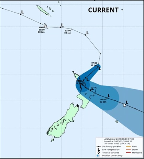
Ex-Cyclone Hale set to become a one in 20-year event
Fresh off a briefing with MetService and Waikato Regional Council, our emergency management team has been advised that 400mm of rain is now forecast to fall for the event through to 10pm tonight, meaning ex-cyclone Hale will likely be a one in 20-year storm event.
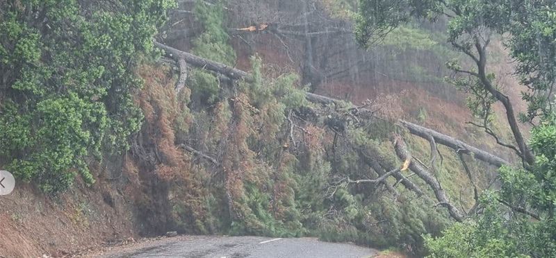
While the cyclone is set to begin easing off tonight and through tomorrow, our catchments are struggling to cope so expect widespread surface flooding, slips, storm surge, and road closures to continue.
There are reports of power outages in Kōpū, Ōpoutere, Whenuakite, Hot Water Beach, Whitianga, Waiau and Whangapoua. Around 900 households in total are affected. Powerco are working to restore connections. Check for updates on their website.
“We have another six to eight hours of this cyclone at its current intensity, so the message to everyone is stay off the roads and beaches for your own safety – it’s dangerous,” says our Civil Defence Controller Garry Towler.
Our next full update will be early this evening. In the meantime, if there are any significant updates on our roads we’ll be posting them on our Facebook and Instagram accounts.